The Ecology Seen from Above: What Drones Change About Environmental Observation
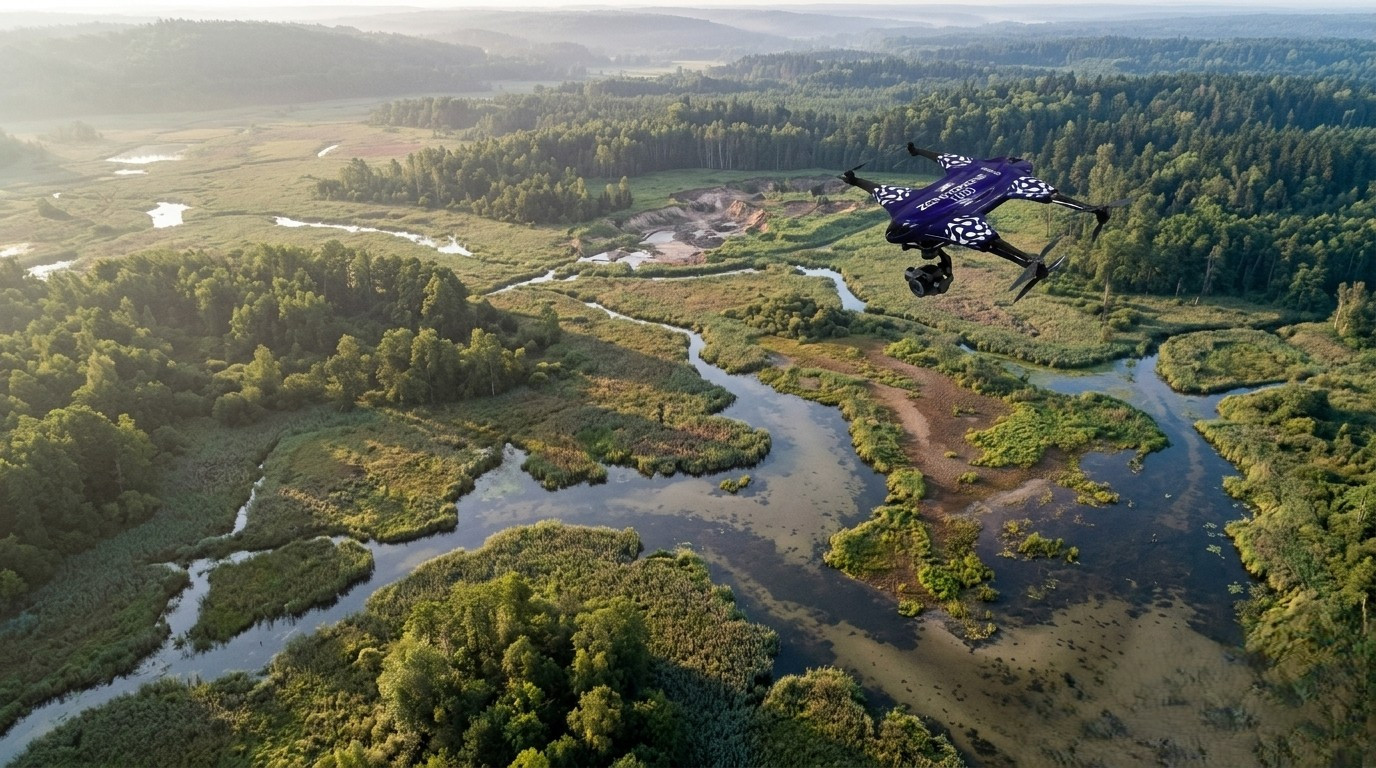
A wetland can look stable from the path beside it. Reeds move in the wind, water gathers in familiar channels, birds disappear into vegetation. From ground level, the landscape arrives as fragments: a bank here, a stand of plants there, a patch of exposed soil farther away. The observer is inside the environment and therefore unable to see much of its shape at once.
From above, the same place becomes something else. Waterways connect. Vegetation forms boundaries and gradients. Areas of erosion become visible as part of a larger pattern. A disturbance that seemed isolated may turn out to extend across an entire edge of the wetland.
This shift in scale is one reason drones in environmentalism are interesting beyond their novelty as flying machines. Their importance lies in a change in the conditions of observation. They occupy a space between the person walking through a landscape and remote-sensing systems operating far above it: close enough to produce detailed images, mobile enough to revisit particular locations, and relatively flexible in where and when they can be deployed.
That does not mean the view from a drone is automatically more truthful. Every instrument makes some things visible while obscuring others. The more consequential question is what happens when environmental knowledge increasingly depends on images and measurements collected from the air.
The problem of seeing an environment
Environmental conservation has always faced a basic difficulty: ecosystems rarely fit within the scale of human attention.
A researcher can examine individual trees but not simultaneously perceive the structure of an entire forest. A conservation worker may observe animals at a watering site without knowing what is happening across the surrounding habitat. Coastlines, marshes and river systems can extend across areas that are physically difficult to traverse. Some environments are steep, unstable, flooded, densely vegetated or otherwise dangerous to enter.
Time makes the problem harder. Ecosystems are not static objects waiting to be documented. Rivers shift course. Shorelines retreat and accumulate sediment. Vegetation changes with seasons and rainfall. Forest canopies respond to storms, fires, disease and human disturbance. Animals move through territories that rarely correspond to the boundaries people draw on maps.
Understanding such environments therefore requires repeated observation at several scales.
Historically, this has meant combining field surveys, maps, satellite imagery, aircraft observations, fixed sensors and local ecological knowledge. Each method reveals something different. Satellites can provide broad spatial context but may not always offer the resolution, timing or viewing conditions required for a particular local question. Fieldwork provides depth and direct experience but is constrained by terrain, time and the physical reach of the observer.
Drones add another layer rather than replacing these methods.
A viewpoint between footsteps and satellites
Environmental monitoring with drones is valuable partly because the aircraft can operate at a scale that corresponds surprisingly well to many conservation problems.
A UAV can photograph a riverbank, forest plot, coastal section or wetland from above and produce a sequence of overlapping images. These images can be processed into maps or three-dimensional representations of terrain and vegetation. Repeated flights can make it possible to compare the same place over time.
The result is not merely a prettier photograph. It can become a spatial record.
This matters because many environmental changes are relational. A bare patch of soil becomes meaningful when its position relative to a stream is visible. A broken section of vegetation matters differently if it forms part of a corridor used by wildlife. Coastal erosion becomes easier to interpret when successive surveys show how the boundary between land and water has shifted.
UAV environmental monitoring therefore changes the scale at which questions can be asked. Instead of choosing only between an individual observation and a regional overview, researchers can examine intermediate patterns: the shape of a habitat, the distribution of vegetation across a site, or changes occurring along a specific stretch of coastline.
There is also a practical dimension. A drone can observe places where sending people would be difficult or unnecessarily risky: unstable slopes, flooded terrain, cliffs, damaged forests or sections of coastline with limited access. In such cases, aerial observation is not simply about efficiency. It can reduce the need to place observers directly in hazardous environments.
Yet distance creates its own limitations. A machine may safely cross a ravine, but what it records still needs interpretation from people who understand what exists on either side.
When habitat becomes pattern
Perhaps the most powerful contribution of aerial observation is its ability to reveal environmental structure.
Habitats are often described through categories—forest, grassland, wetland, coast—but living landscapes rarely respect clean classifications. They are mosaics. Vegetation density changes gradually. Water and dry land overlap seasonally. Human infrastructure interrupts ecological corridors. Small clearings, drainage channels and fragmented edges may have consequences disproportionate to their size.
Drones for environmental conservation can help document these transitions at fine spatial scales. Aerial imagery can support habitat mapping, vegetation assessment, restoration monitoring and surveys of environmental disturbance. When flights are repeated under comparable conditions, they can also help observers recognize change rather than simply record a single moment.
Forests illustrate both the possibilities and the limits.
From above, imagery can reveal canopy gaps, visible damage, changes along forest edges and patterns in vegetation cover. Aerial surveys may allow teams to examine areas that would take much longer to cross on foot.
But a canopy is also a ceiling. What is easily visible from above may say relatively little about organisms living beneath it, soil conditions below the surface or ecological processes occurring at ground level. A forest cannot be reduced to the geometry of its crowns.
Wetlands create a similar tension. Their boundaries may be easier to map from the air, and aerial images can reveal relationships among open water, vegetation and exposed ground. Yet hydrology, water chemistry and biological interactions cannot simply be read from pixels.
The strength of the aerial perspective is pattern recognition. Its weakness appears when pattern is mistaken for explanation.
Wildlife without the fiction of invisibility
Drones for wildlife conservation raise an especially complicated question: can observation become less intrusive by moving the observer into the air?
In some circumstances, aerial platforms can allow researchers to examine open habitats or search areas without physically moving teams across sensitive ground. They may assist with locating animals, documenting their distribution or surveying habitat around them. Sensors beyond conventional cameras can expand what is detectable under suitable conditions.
But a drone is not invisible to an animal.
It produces sound, movement and an unfamiliar silhouette. Different species—and potentially different individuals—may respond differently to its presence. An altitude or flight pattern that causes little obvious reaction in one setting could be disruptive in another. The absence of dramatic movement does not necessarily prove the absence of disturbance.
This makes wildlife observation a useful example of a broader principle: technological distance is not the same as ecological neutrality.
Responsible operation requires the objective of data collection to be weighed against the possibility that collecting the data alters the behavior being studied. Flight routes, duration, altitude, season and proximity all become ethical as well as technical decisions.
Sometimes the most environmentally responsible flight may be the one that does not happen.
Coastlines, forests and landscapes that refuse to stay still
The appeal of drones becomes particularly clear in environments defined by change.
Coastlines are boundaries in constant negotiation. Waves, tides, sediment, storms, vegetation and human construction continually reshape them. Aerial surveying can provide detailed snapshots of beaches, dunes, cliffs, estuaries and other coastal features. Repeated observations can help establish how visible forms shift over time.
Forests change more slowly in some respects but can be transformed rapidly by fire, storms, clearing or other disturbance. UAV imagery can contribute to assessments before and after such events, especially where access is difficult.
In rivers and wetlands, aerial views can help show channel structure, inundation patterns and the spatial relationship between vegetation and water. In restoration projects, imagery can provide a way to observe whether physical changes to a site are developing as expected.
What connects these uses is not the drone itself. It is repetition.
One aerial image may be descriptive. A sequence of carefully comparable observations can become evidence of transformation.
That distinction is central to drone technology for sustainability. Environmental value does not come from producing large quantities of imagery. It comes from designing observations that allow meaningful comparisons and combining those observations with other forms of knowledge.
The abundance problem
Drones solve one problem of environmental research and intensify another.
They can make data easier to collect. But easier collection produces more data, and more data demands storage, processing, classification, quality control and interpretation.
A short survey can generate hundreds or thousands of images. Turning them into useful environmental information may require photogrammetry, geographic information systems, remote-sensing methods and substantial computing resources. Differences in lighting, season, sensor configuration or flight path can complicate comparisons between surveys.
This is where the cultural image of the autonomous drone becomes misleading. The aircraft may fly a programmed route, but the knowledge produced around that flight remains deeply dependent on human decisions.
Someone chooses where the boundary of the survey lies. Someone determines what resolution is sufficient. Someone decides which features should be classified and which changes count as significant. Someone must ask whether an apparent difference represents ecological change or merely different conditions of observation.
The distinction between data and knowledge matters particularly in ecology. Aerial data can show where something appears to be happening. Understanding why it is happening may require soil samples, species identification, hydrological measurements, historical records, interviews with people who know the landscape, or simply walking through the place.
More visibility does not eliminate the need for interpretation. It increases it.
The limits of the flying sensor
There are also stubborn physical constraints.
Small drones have limited flight times, and batteries restrict how much territory can be surveyed during a mission. Wind, precipitation, temperature and visibility can determine whether flying is practical or safe. Dense vegetation can conceal what lies underneath. Water surfaces, shadows and changing light can complicate imagery.
Regulation shapes access to airspace and may limit where, when and how UAVs can operate. Environmental work may take place near settlements, infrastructure, protected areas or borders where permissions and safety requirements are especially important.
The economic barrier is not only the aircraft. Useful environmental monitoring can require appropriate sensors, software, computing capacity, trained pilots, data specialists and ecological expertise.
These constraints should discourage the idea that drones are a universal replacement for established environmental methods. Their usefulness is situational. Sometimes a satellite image is sufficient. Sometimes a person with a notebook and years of local experience will notice what an aerial survey misses.
The interesting future is therefore not one in which drones displace other ways of knowing landscapes, but one in which different forms of observation are deliberately combined.
Who has the right to look from above?
Environmental surveillance also carries social consequences.
A drone surveying a forest, river or coastline may inevitably record people, homes, farms or activities that were not the intended subject of research. The fact that imagery is collected for conservation does not remove questions about privacy, consent, ownership and access.
Who controls the images? How long are they retained? Who can reuse them? Could detailed environmental maps expose sensitive wildlife locations? Could data gathered for conservation later be used for unrelated surveillance?
These questions become especially important when environmental research takes place in inhabited landscapes. The idea of “nature” as an empty space can erase the people who live, work and hold knowledge there.
Responsible environmental monitoring therefore requires more than legal permission to fly. It requires attention to the communities beneath the flight path and to the possible future life of the data after the aircraft lands.
The ethics of aerial observation cannot be separated from the politics of visibility.
A technology for asking better questions
Future drones will probably become more capable: longer endurance, improved sensors, greater automation and increasingly sophisticated systems for processing imagery. Automated classification may help researchers sort enormous datasets and identify patterns that would be difficult to inspect manually.
But greater capability will not resolve the central difficulty of environmental knowledge.
An ecosystem is not simply a dataset waiting to become complete.
It is a web of relationships unfolding across different timescales, many of which cannot be directly photographed. The danger of increasingly precise environmental imagery is that precision can be confused with understanding. A map may become extraordinarily detailed while the causes of the patterns on it remain uncertain.
The deeper contribution of drones in environmentalism may therefore be methodological rather than technological. They allow researchers and communities to move between scales: from organism to habitat, from local disturbance to landscape pattern, from a single observation to a sequence of change.
Used well, the aerial view does not replace the person standing in the forest, marsh or shoreline. It gives that person another way to return to the landscape with better questions.
The drone rises, gathers its images and eventually comes back down. Interpretation must come down with it.